Social
The social impact assessment for the T2D Project focuses on the community, their relationships and their sense of place. This assessment first describes the community in the vicinity of the project, then identifies vulnerable groups and places that are highly valued and would potentially be more sensitive to impacts from the project.
Social impacts can include both beneficial and negative changes to the amenity and character of the area, connectivity to places and relationships that contribute to an underlying sense of community.
Assessments of community related aspects including health, business, traffic and transport, and land use and planning have been undertaken. These aspects contribute to providing a broad understanding of how the community may be affected by the project.
The T2D Project prioritises faster journeys for more efficient travel times and improved road safety whilst enhancing local character and supporting community values and cohesion along the corridor. The Project Design strives to avoid or minimise as far as possible any social impacts during construction and operation of the infrastructure.
- Download
Download a summarised factsheet of the Social impact assessment in PDF format
Approach
The assessments of impacts to social conditions from the project has drawn on data from the Australian Bureau of Statistics Census (ABS, 2021) and the State population projections (2020) population projections for South Australia, 2016-2036.
This social assessment followed the assessment methodology which identified construction and operation activities and their social impacts.
Some activities and social impacts relating to the community within or adjacent to the project are interrelated to other topics including health, business, traffic and transport and land use and planning. To avoid repetition the interrelated activities and impacts identified in the related assessments are not replicated in this section of the PAR.
Assessment area
The map below shows the social assessment area, incorporating communities and land extending approximately 1.6km either side of the project corridor (about a 20-minute-walk):
Existing environment
Population
The social impact assessment area had a total population of 84,240 according to the 2021 ABS Census.
The observed and projected population change in the surrounding local government areas (LGAs) and Adelaide metropolitan area of Greater Adelaide as a whole are generally modest. The population change (2011-2021) was 12% over 10 years in the LGAs surrounding the project, compared to 13% for the Adelaide metropolitan area.
Housing and residence
The social impact assessment area have higher proportion of higher density housing than the surrounding LGAs and the Adelaide metropolitan area of Greater Adelaide. In addition, there are higher numbers of people who rent in the assessment area, suggesting a more mobile community than the surrounding LGAs and the Adelaide metropolitan area.
Employment
Noting South Australia's unemployment rate of 3.8% in late 2023, at the time of the 2021 ABS Census unemployment rates were commonly about 4% to 7%. These rates were comparable to the surrounding local government areas, while average income was similar to that of wider metropolitan Adelaide.
Income
Income in the assessment area is similar to the surrounding LGAs and the Adelaide metropolitan area. Variation within the assessment area is generally less than the variation to LGAs and Adelaide Metro area. The Darlington area is an outlier, with 12% lower average income.
Vulnerable Groups
The social impact assessment considers the potential effects and benefits for vulnerable groups resulting from the project. Vulnerable groups refer to those individuals or groups who for numerous reasons may be more likely to be adversely affected by the potential project effects.
For the purposes of this social context profile, potentially vulnerable groups include, but are not limited to:
- children
- young people
- older people
- people with adverse health conditions or a disability who require assistance
- people with caring duties, including parents with young children
- people with low incomes, including those outside mainstream employment pathways
- recent arrivals, particularly those from non-English speaking backgrounds
- Aboriginal and Torres Strait Islander people
- people from culturally and linguistically diverse backgrounds, particularly those who may experience a combination of other vulnerabilities
- people whose sexual orientation and/or gender identity may result in social exclusion.
Aboriginal and Torres Strait Islander people represent a small population in the social impact assessment area. Importantly however, approximately half of the population of Aboriginal and Torres Strait Islander people live in the immediate vicinity of the open motorway element of the project. This local population will likely be disproportionately vulnerable to project impacts relative to other population groups.
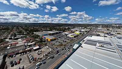
Land use and urban form
The T2D Project traverses a diverse range of highly urbanised areas. Land uses vary between medium density, residential suburbs with high levels of residential amenity and historical landmarks, to a mix of light industrial precincts and with commercial/retail areas interspersed. The existing land use and urban form influence the communities’ relationship towards an area often described as a sense of place.
Community facilities and services
The SA Directory of Community Services and government facilities listings shows 172 facilities and services in the social impact assessment area with the largest type being recreational facilities (57). The listing shows that community services facilities, health and disability organisations and places of worship/faith-communities having similar numbers (15-17) across the assessment area.
There is also between one to eight each of childcare services, schools, employment services, supported accommodation, community centres, community organisations, education services, emergency and hospital services within the assessment area.
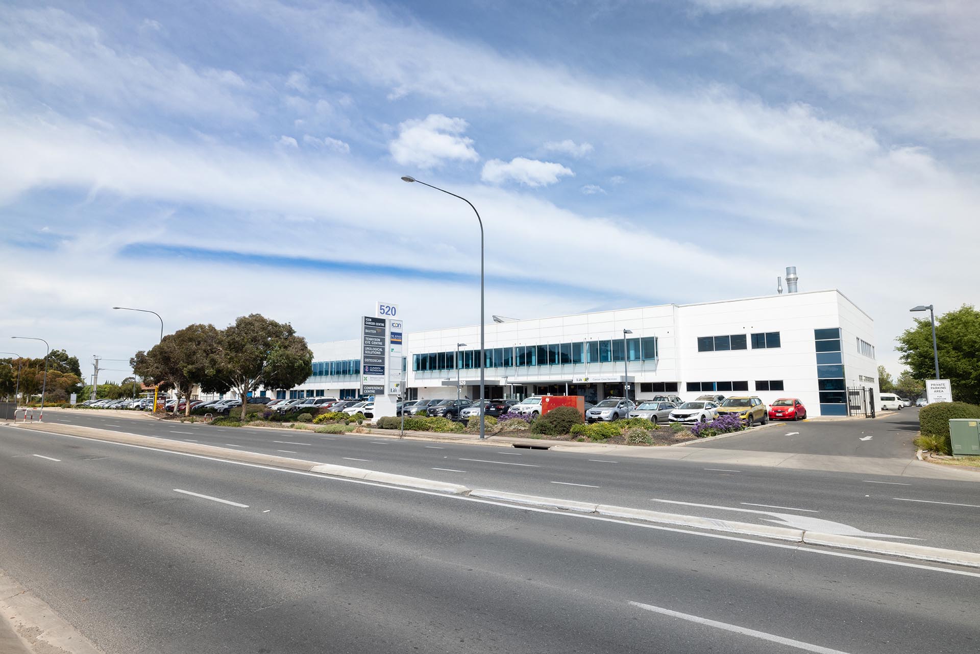
Photo: Tennyson Centre Day Hospital.
Potentially sensitive community facilities
Potentially sensitive community facilities and services are those where there is a higher likelihood of vulnerable groups using the facility and/or service.
These community facilities have been considered where they may have their access and amenity most directly affected by surface project elements such as surface road and open motorway elements. There are approximately 30 potentially sensitive facilities and services that have been identified in the vicinity (400m either side) of surface road and open motorway elements.
The majority of these potentially sensitive facilities and services include:
- community services - such as careers support services, child protection services, support for low-income people)
- community organisations like community groups for culturally and linguistically diverse or returned service people
- medical, health and disability organisations
- childcare facilities.

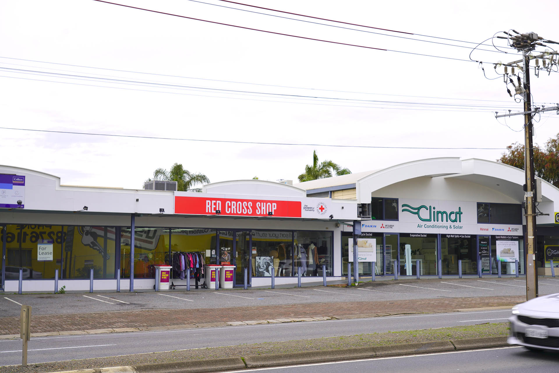
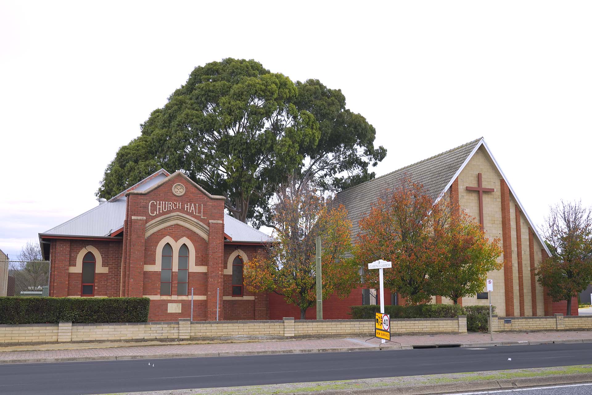
Photo: Richmond Primary School, Red Cross Op Shop, and St Francis of Assisi Church.
The following map shows potentially sensitive facilities and public transport and cycling routes:
Map: Potentially sensitive community facilities
Map disclaimer
Road access and connectivity
The community in the project area is serviced by several major transport facilities that provide access and connectivity within and adjoining the project area and the wider Adelaide central business district and region.
As a major arterial road, there are restrictions on how road users can gain access to and from South Road. Currently, left turns on to and from South Road are generally permitted. Right turns are more restrictive, with some sections of raised median at local road junctions restricting right turn movements. The locations of raised medians strongly influence traffic patterns on the local road networks.
Ease of community access relies heavily on local road connections to South Road. Access is constrained by raised medians on South Road and high traffic volumes during most business hours and weekends, making right turns impractical/challenging in many locations. Other impermeable transport infrastructure such as the Seaford passenger rail line which creates an obstacle for accessibility to and from South Road and to a much lesser degree, the Glenelg tram line.
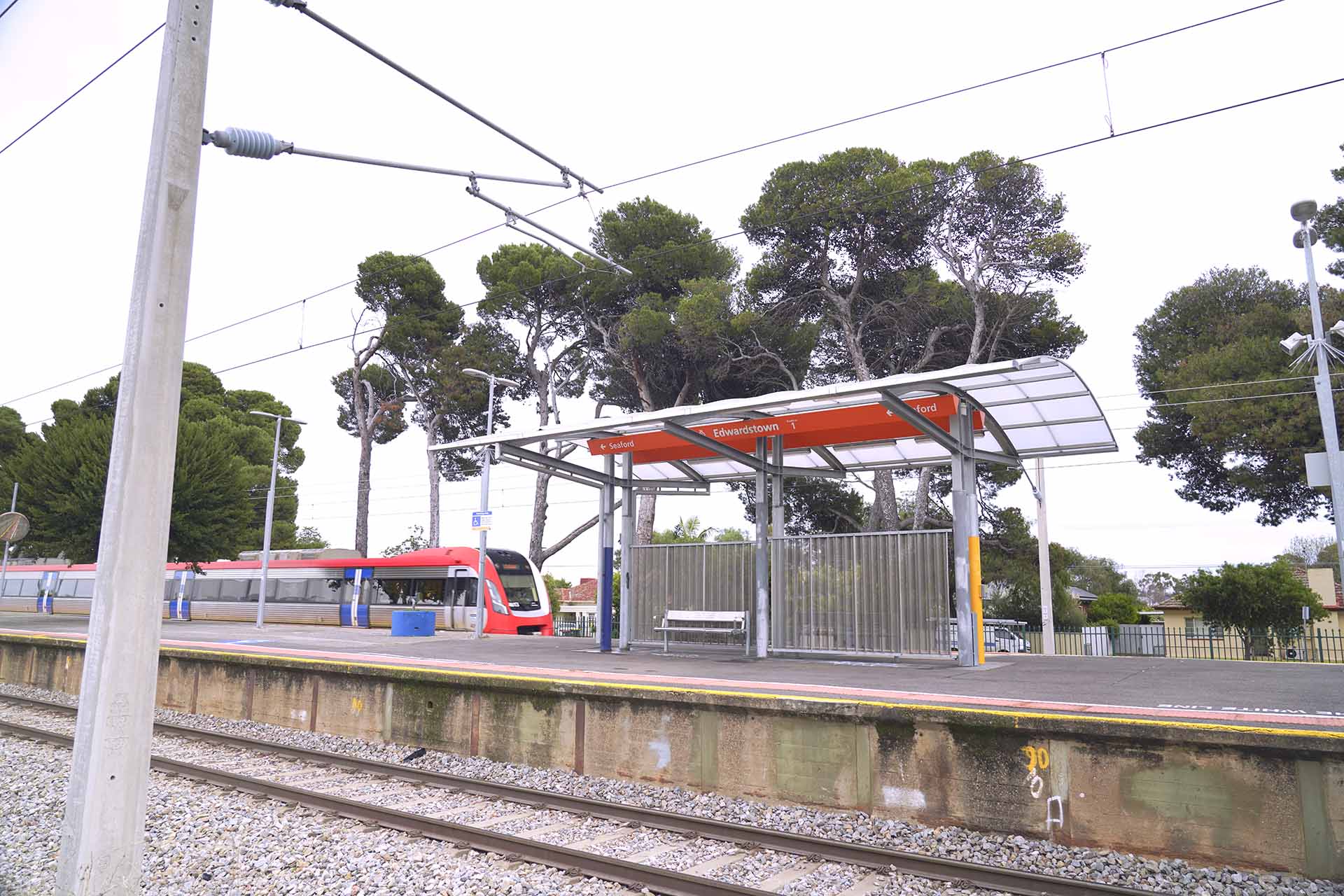
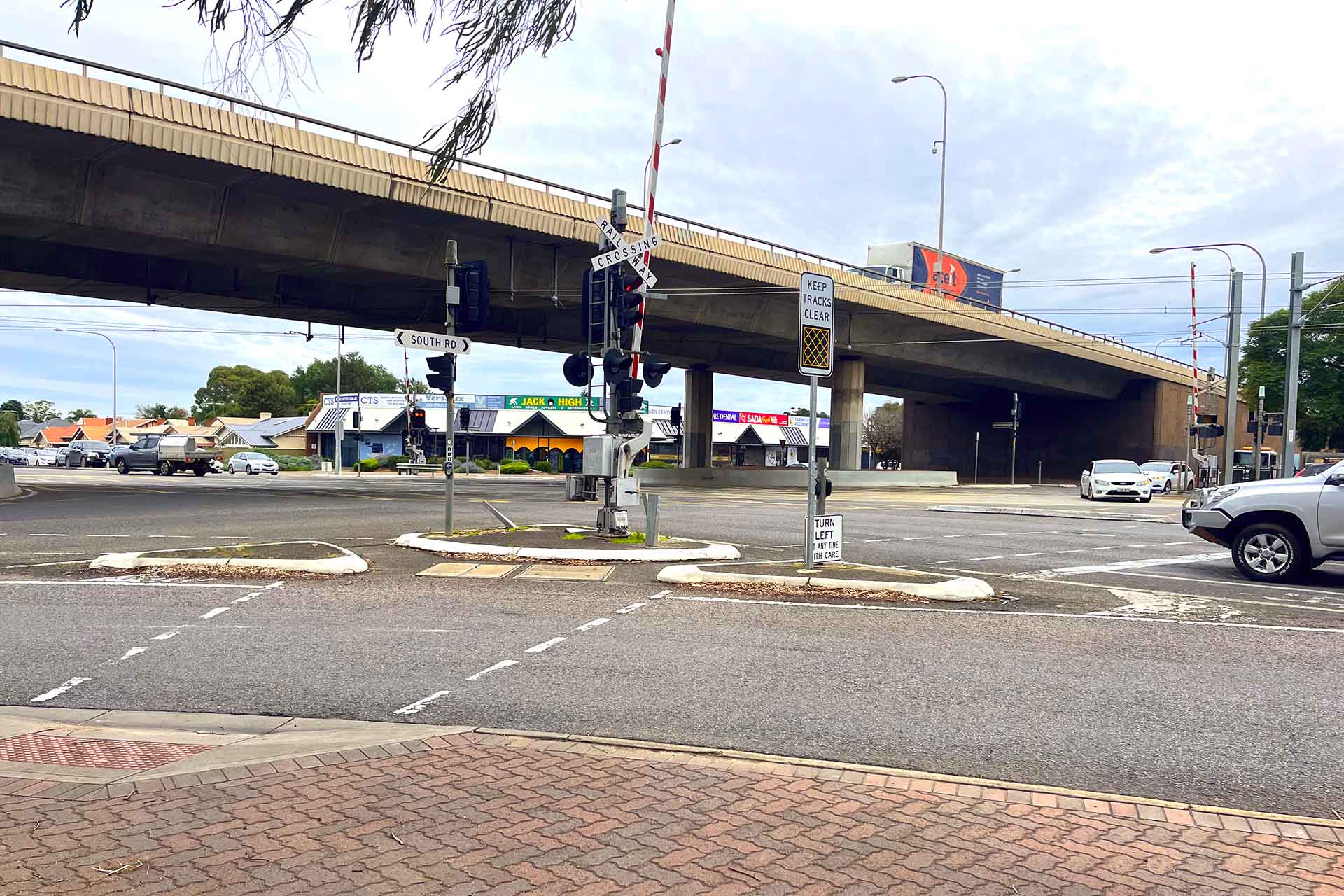
Photo: Edwardstown Train Station and Cross Road/South Road Overpass.
The following map shows pedestrian and cyclist activity hotspots in the vicinity of the project area:
Map: Pedestrian activity hotspots and cyclist activity hotspots
Map disclaimer
Further information on the performance of the existing traffic and transport network is provided in the traffic and transport assessment.
Community values and cohesion
Community values relating to local amenity and character refer to natural and physical qualities or characteristics that contribute to a person’s appreciation of their surroundings. Local amenity and character in the project assessment area is generally considered through a diversity of land uses including:
- residential suburbs with high levels of residential amenity
- historical landmarks
- mix of light industrial precincts
- commercial/retail areas
- recreational areas and facilities.
Community cohesion refers to the connections and relationships between individuals, groups and neighbourhoods and is encouraged by the existence of local social infrastructure, a sense of local identity and opportunities for community participation.
Community cohesion varies across the assessment area and adjoining areas depending on stability of the population, access to community facilities including education, sport and recreation, open space and community services such as good access to local GPs, cafes, hotels and entertainment venues.
Feedback from the community engagement undertaken for the T2D Project to date has been mostly positive with overall support for the project’s objectives, see Past engagement activities. Key areas of interest included visual impact, green space, connectivity and concerns about construction impacts and traffic safety.
Impacts and mitigation measures
The construction and operation of the project has the potential for both negative and positive social impacts to the community. The social impacts of the project’s activities have been assessed and their mitigation and management measures identified using the same methodology applied to all aspects of the PAR. See the assessment methodology for more details.
The potential area of impact has been identified to extend approximately 400m (about a 5-minute walk) from the project corridor. This is a smaller area than the wider assessment area which characterises the existing neighbourhoods and sets the social context.
Construction impacts
Construction will include excavations for sections of lowered motorways and portal dive structures. The two sets of twin tunnels connecting them will be excavated using tunnel boring machines (TBMs). Generally, the community in the vicinity of the open motorway sections of the T2D Project will experience more construction related impacts than those where the TBM is operating to build the Northern and Southern Tunnels .
Social impact mitigation requirements for construction
Potential construction impacts | Key mitigation measures |
|---|---|
Temporary and permanent relocation of landowners and/or residents, businesses, and community facilities and services. This has potential to result in temporary and permanent hardship, affect individuals’ wellbeing and livelihoods and possibly impact on social wellbeing through changes to community networks and community cohesion. It can change the local character and reduce community connection and negatively impact the sense of community identity. | The project has/will:
|
Continued, ongoing construction over an extended duration impacting local amenity of residents and businesses. This has the potential to negatively affect the perception of local public safety and contribute to “construction fatigue”. | The project will:
For further information visit About construction. |
Amenity impacts of construction including noise and vibration, dust and airborne emissions from plant and equipment. This has the potential to impact residents, businesses, users of community and public facilities near the project. | The project will:
For further information regarding mitigation measures during construction refer to the noise and vibration and air quality assessments. |
Visual impact during construction. Increased heavy and light vehicle movements impacting amenity during construction. Potential to temporarily impact local amenity, social wellbeing, local character, perceptions of public safety, reduce outdoor activities, affect patronage of community facilities and local businesses as well as reducing community connection and wellbeing. | The project will:
|
Construction activities impacting local street parking and road access needing temporary closures or detours. This has the potential to cause inconvenience, longer travel times, reduced accessibility to businesses, services and facilities impacting on community wellbeing. | The project will:
|
Construction impacting public transport and existing pedestrian and cyclist infrastructure. This has potential to reduce active transport and increase vehicle use that may result in individual and community health impacts. | The project will deliver a TMP that:
|
Construction temporarily impacting educational, community and recreational facilities. This has potential to reduce amenity and accessibility, reduce community connection and belonging to the area and negatively impact the sense of community identity. | The project will deliver a TMP that:
|
Operational impacts
The activities that result in the potential for operational impacts have been identified and mitigation measures to minimise these impacts have been defined.
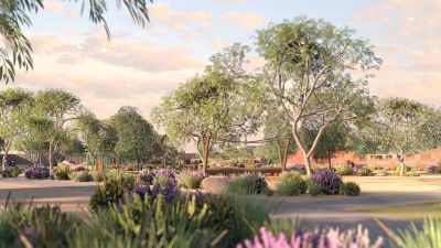
The majority of operational impacts are positive and as such, mitigation measures have only been identified for adverse impacts with design opportunities identified to further enhance the project’s benefits. The image below is an example of the type of city-shaping park concepts that the T2D Project designers have been working on to enhance the sense of place for the local community.
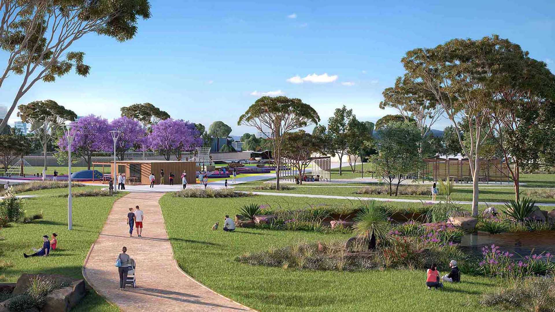
Artist's impression: City shaping park concept.
Social impact mitigation requirements for operation
Potential operational impacts | Key mitigation measures |
|---|---|
Improved traffic connectivity and network efficiency to those living near and those travelling through the project corridor. This has potential to improve individual and social wellbeing and positive changes to community networks and community cohesion. | Positive impacts, no mitigation required. The Urban Design Strategy (UDS) will consider placemaking activities to add to local character, social activation and community identity. |
Improved east-west active transport connectivity above the northern and southern tunnels resulting in reduced traffic, improved road safety, improved streetscape, and higher amenity. This has potential to improve individual and social wellbeing and positive changes to community networks and community cohesion. | |
Improved motorist and active transport user safety as a result of changed east-west traffic conditions resulting in minimising the rate of crashes along the corridor. This has the potential to improve individual and social wellbeing. | |
A more connected and efficient road network and traffic conditions will have a positive effect on improved spatial accessibility and to businesses services and facilities, including community facilities. This has the potential to improve individual and social wellbeing. | |
Above the northern and southern tunnels improved noise, air quality, traffic and amenity conditions, including for those for community and educational facilities along the current South Road area anticipated once operation commences. This has the potential to improve individual and social wellbeing. | |
Once operational, the project has the potential to be a positive outcome for community and social cohesion as it provides residents, businesses, and community facilities certainty to plan for the future, where both T2D and the NSC are complete. | |
Some changes to access point locations may have some disadvantages including reduced east west connectivity in the vicinity of open motorway sections, which may present added challenges for pedestrians, cyclists and vehicles to move from one area to another. | The project will engage with the community during consultation to assess and mitigate the connectivity issues during the design stage of the project. |
Increase in visual ‘hardscape’ from elevated surface elements of the motorway and noise walls. These have potential to result in long-term effects to visual amenity impacting local character and community identity for community, businesses, and facilities. | The project will:
For further information regarding mitigation measures during design refer to the Landscape and visual amenity section of the PAR. |
Ongoing noise and vibration, air pollution, traffic and transport, and amenity impact once operation commences. This has potential impact to residents, businesses and users of community and public facilities near the project. | The project will:
For further information regarding mitigation measures during operation refer to the Noise and vibration and Air quality sections of the PAR. |
How impacts will be minimised or avoided
During design the application of the Department’s Master Specification (MS), with its links to relevant parts of the Environment and Heritage Technical Manual (EHTM) will minimise the social construction and operational impacts to the community within and immediately adjacent to the project corridor.
Of relevance to the social discipline are:
- MS PC-PL1– Framework for Planning Studies
- MS PC-PL2 – Planning Investigations
- MS PC-CS1 – Community Engagement and Media Management
- MS PC-CS2 – Small Business Support
- MS PC-ENV1 – Environmental Management
- MS PC-ENV2 – Environmental Protection Requirements
- MS PR-PF-D1 – Designing for Accessibility
- MS PR-LS-D1 – Landscape and Urban Design
- MS PC-SM1 – Traffic and Pedestrian Management
- MS PC-EDM2 – Safety Management in Design.
Additional MS and EHTM requirements for social impacts related to air quality, noise and vibration, traffic and transport are provided with those sections of the PAR.
The MS and EHTM require the project to undertake this initial detailed assessment; reinforcement of this assessment will continue to be undertaken and mitigations refined as detailed design and construction planning progress.
Further reports that document required outcomes that minimise social impacts during construction and operation include:
- community and media engagement plans
- wayfinding strategies (construction and operation)
- delivering outcomes from the UDS
- committing to safety in design
- a project specific CPTED strategy
- incorporating sustainability outcomes, including a Green Infrastructure Assessment
- Work Health Management Plans and Safe Work Method Statements for construction
- Transport Management Plans
- Contractor’s Environmental Management Plan.
Approvals
Approvals, permits and authorisations
The following table provides a summary list of the likely land use and related planning approvals and authorisations relevant to social impact required to progress the project to delivery.
Summary of relevant approvals
Legislation | Approval |
|---|---|
Required | |
Section 20 of the Highways Act 1926 allows the Commissioner of Highways to acquire land required for purpose of road construction this includes the T2D Project. Section 20(5) of the Highways Act 1926 exempts land acquired under Section 20 from approval requirements under the Planning, Development and Infrastructure Act 2016 (PDI Act) – unless it is in relation to a State Heritage Place. Powers to carry out roadworks and tree damaging activity (for the purposes of road safety pursuant to Clause 26a). Prepare or update road widening plans. Specific exemptions apply for land acquired from application of the PDI Act under Section 20 Part (5) of the Highways Act 1926. However, under Section 20 Part (6)(a) of the Highways Act 1926, exemption of the PDI Act does not apply where a State Heritage Place directly or indirectly affects the heritage value of the place. This only applies insofar as is relevant to the State Heritage Place. | |
While the PDI Act is relevant to the T2D Project as it regulates the development of land in South Australia, it does not apply where land is owned by or acquired under Section 20(5) of the Highways Act, except in relation to a State Heritage Place. Therefore, the PDI Act will have limited application for this project. This excludes the City Shaping activities where the PDI Act still applies. The PDI Act is supported by various strategies, reports and legislation which guide land use planning across the state, including Infrastructure SA’s 20-Year Strategy, the 30-Year Plan for Greater Adelaide (2017 update) and State Planning Policies for South Australia. | |
Details South Australia’s land acquisition procedures and requirements, including notification and compensation. Provides grounds and process for objection to acquisition. The project will need to follow the acquisition process outlined by the legislation. Including the adherence to the rights and obligations of owners, obligations of the acquiring Authority and compensation limits and triggers. The LA Act provides for the acquisition of land on just terms. The LA Act details South Australia’s land acquisition procedures and requirements, including notification and compensation. The process of land acquisition is governed by the LA Act. | |
This Act guides the protection of identified heritage places that may be impacted by the T2D Project. Development applications in relation to a State Heritage Place will be referred by the State Commission Assessment Panel to South Australian Heritage Council for comment. | |
Policy and plans (refer to Business for details) | Demonstrate compliance. No specific Department approval required. The project’s outcomes align strongly with key South Australian and Australian Government priorities. |
Next steps
The Project Assessment Report (PAR) community consultation period concluded in April 2024. We thank you for your feedback.
The valuable information and local insights received during the consultation phase of the PAR are being considered by the project team and will inform the ongoing refinement of the T2D Project.