Geology and groundwater
Considering a significant amount of the motorway in the T2D Project is located in tunnels, it is vital to understand the conditions that the project will be built in to ensure structural integrity and environmental protections are adequate.
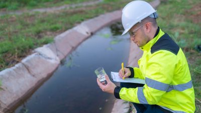
Extensive field investigations including bore holes, soil and rock sampling, soil testing and groundwater monitoring have been undertaken to determine the types of soil, rock and groundwater conditions that exist in and around the project area. These assessments have been used to inform and underpin project planning and design.
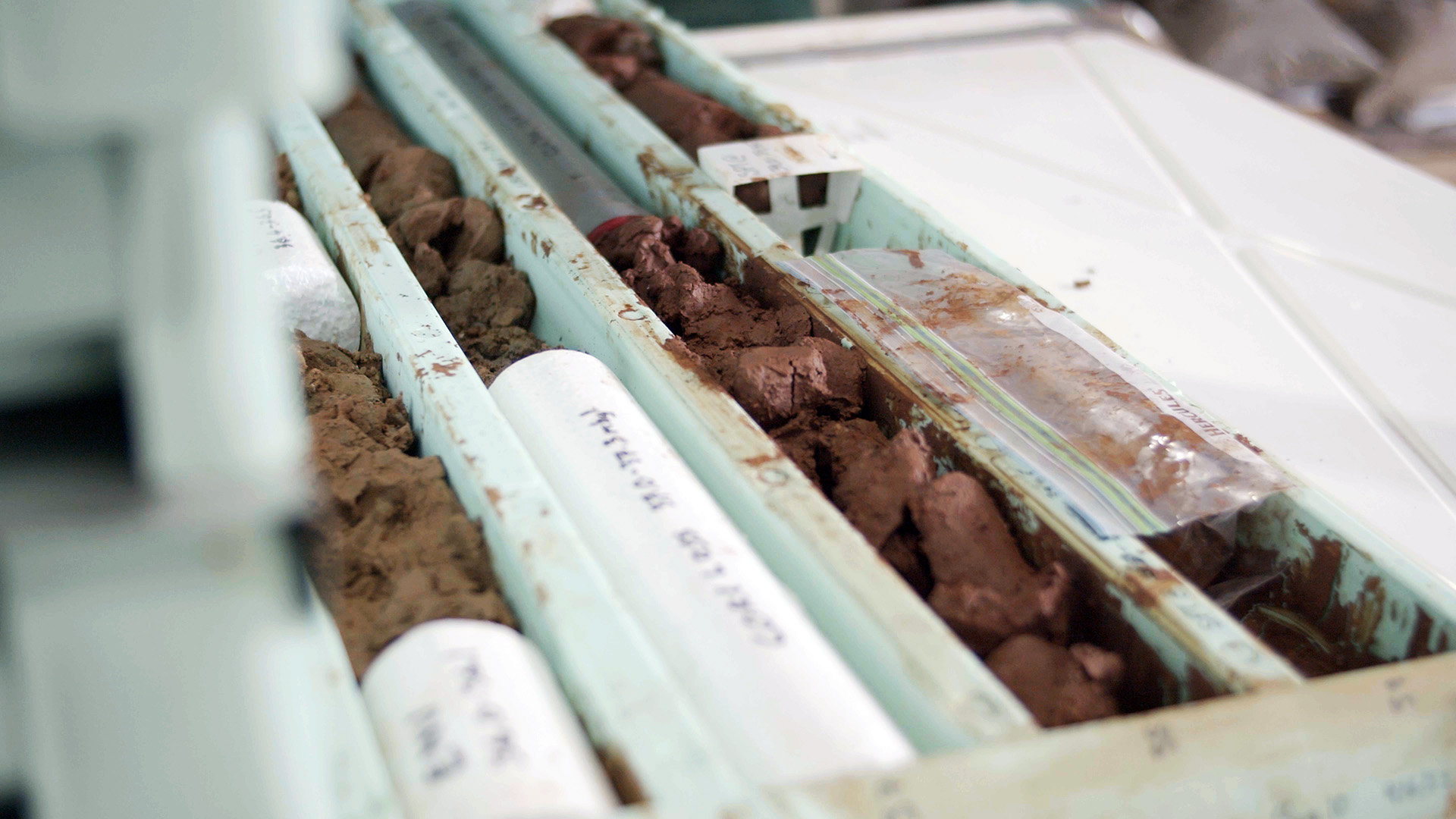
Photo: Core samples taken for testing of T2D Project corridor.
- Summary
Download a summary of the Geology and groundwater impact assessment in PDF format
Approach
The assessments of impacts to geological and groundwater conditions from the project have been drawn from the thousands of tests and large number of studies that were principally undertaken for the planning and design of the engineering required for the project tunnels, open motorway and structures.
The assessments identified a number of construction and operational activities and impacts relating to geology and groundwater. The assessments followed the same approach as those outlined in the assessment methodology.
A number of activities and impacts relating to geology and groundwater within or adjacent to the project are interrelated with site contamination, surface water and ecology.
To avoid repetition the interrelated activities and impacts identified within the site contamination, surface water and ecology assessments are not replicated in this geological and groundwater assessment.
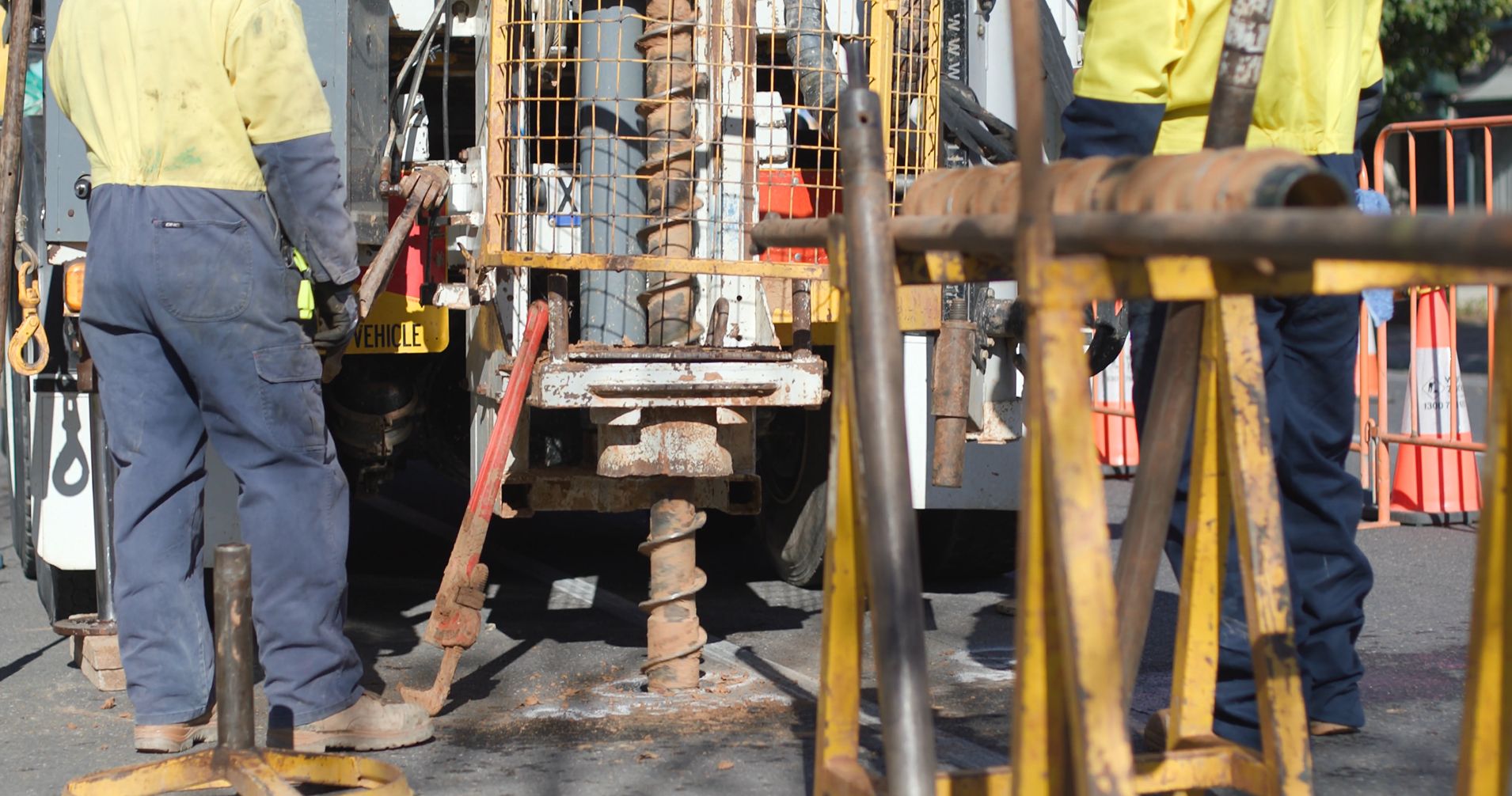
Photo: Investigative drilling undertaken as a part of the T2D Project.
Assessment area
The assessment area for geology and groundwater is separated into the three sections of the T2D Project and is closely aligned with the site contamination assessment area.
The following map shows ground investigation sample locations along the project corridor:
Map: Ground investigation sites
Map disclaimer
Existing environment
The T2D Project is located in relatively flat area, with a gradual rise in elevation towards the foothills in the south. The conditions just under ground level, where the entrance and exits to the tunnels and open motorway sections will be located, feature soils, coarse-grained sands and gravels and clay most commonly deposited by ancient rivers or waterways.
Deeper soils that the tunnels will move through are made up of layers of sands and gravels located within numerous clay layers (aquitards). The design for the Southern Tunnels extends downwards through these layers and variably encounters limestone and sandstone at depth. A series of shallow confined aquifers are located in these (quaternary) sands and gravels with a deeper aquifer located in the underlying (tertiary) sandstone as shown in the cross section of the Southern Tunnels, northern portal below.
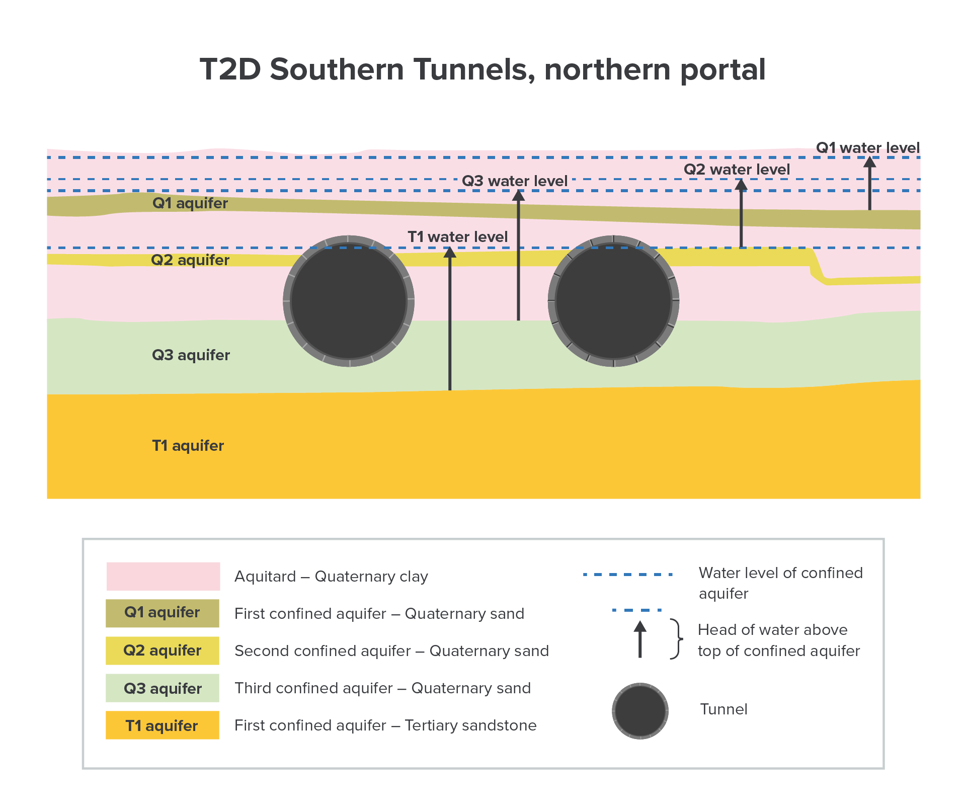
Diagram: Cross section towards the northern end of the Southern Tunnels
The Northern Tunnels are mostly located in the clay layers, but the southern portion of these tunnels encounters an ancient, non-active fault zone, the Para Fault, which has pushed underlying sandstone upwards. Sandstone and limestone are common at this depth across Australia and are relatively easy for a tunnel boring machine (TBM) to operate in. The below cross section shows the general geology below the project and the wider Adelaide metropolitan area.
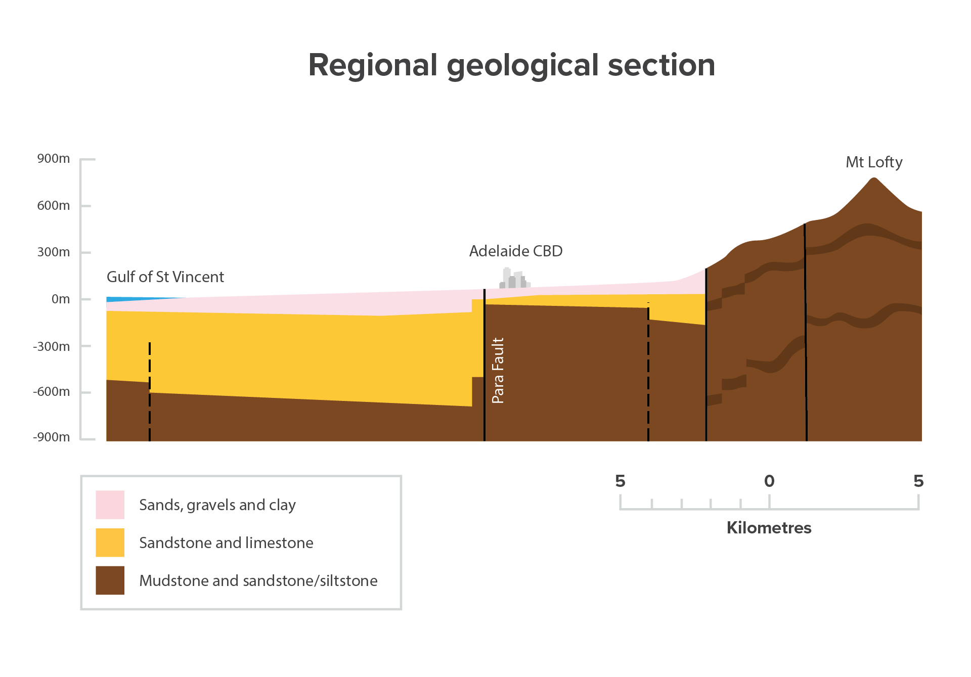
Diagram: Regional geological section showing general geology below the T2D Project and wider Adelaide metropolitan area
Groundwater across the T2D Project generally drains from the hills in the east towards Gulf St Vincent in the west. Two deep aquifers located in the underlying sandstone extend along the length of the alignment. Groundwater in the deeper aquifers is typically under pressure, which is also common.
Impacts and mitigation measures
The construction and operation of the project has the potential to impact on the geological and groundwater conditions which in turn could cause unwanted impacts for the community or to the environment if not properly managed.
The objective of the geological and groundwater impact assessment is to document and assess the social and environmental (including heritage) risks during construction and operation of the project and identify management and mitigation measures to reduce these risks.
Further, assessments have also sought to determine the probability of underground construction shifting or impacting the ground at the surface – known as ground settlement.
Ground settlement issues can include aesthetic damage such as fine cracks in buildings and infrastructure through to severe stability and structural damage. This can occur if the removal of soil and groundwater required for tunnelling and construction is not managed properly.
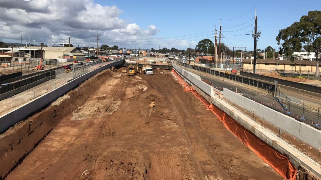
Photo: Excavation undertaken for the Torrens Road to River Torrens project (T2T).
Construction impacts
Construction of the T2D Project will include excavation for sections of open motorways and portal dive structures which will connect to the two twin tunnels. The tunnels will be excavated using tunnel boring machines (TBMs) at an underground depth which is mostly below the water table.
Dewatering of some underground water will be required to enable construction of the open motorway section. This will also reduce pressure in some aquifers to prevent future uplift of excavation and construction at the tunnels and their entrances and exits.
The key impacts from construction and their principal mitigation measures are described below. It is important to remember that contamination is addressed in site contamination. The groundwater impacts discussed below relate to non-contaminated groundwater impacts only.
Potential construction impacts | Mitigation measures |
|---|---|
Geology | |
Tunnels and portals: Ground settlement due to tunnelling (ground loss and groundwater removal) in portals or shallow cover sections of tunnels | The project will:
|
Surface works: Potential for perched water (water trapped above the water table) due to local surface water infiltration and leaking services | The project will:
|
Shallow excavations: Any previously placed fill encountered in underground services trenches, backfilled pug holes and sand lenses in clays are likely to be unstable and a safety hazard in steep sided unsupported excavations | The project will:
|
Groundwater | |
Removal of groundwater causes supply loss in existing pumping wells | The project will:
|
Dewatering causing regional decline in groundwater storage | The project will:
|
Tunnel construction approach cross connects aquifers which could negatively impact water quality | The project will:
|
Video: Ground investigations and monitoring groundwater.
Operation impacts
The key impacts from operations and associated mitigation measures are described below. Subsidence impacts often occur over a long duration, although the impact may be experienced in the operational phase, the event that initiated the impact often occurs in the construction phase.
Potential operational impacts | Mitigation measures |
|---|---|
Geology | |
Ground settlement in the vicinity of tunnelling impacting underground services, residential and commercial properties | The project will:
|
How impacts will be minimised or avoided
The project design has incorporated the results from extensive and detailed site investigations including careful consideration of risks and mitigation measures to minimise ground settlement and other risks.
For example, specialised retaining wall construction techniques, such as diaphragm walling, will reduce water ingress and mitigate impacts from any soil movements in the cut and cover tunnel sections and the open motorway, while base slabs below the water table will be appropriately reinforced and anchored to prevent uplift. The TBM tunnels are progressively lined by the TBM as excavations advance to prevent groundwater ingress and minimise surface settlement.
The Department’s Master Specifications (MS) have specific requirements applicable to the mitigation of impacts while the EPA and SafeWork SA practices and guidelines will also be followed.
These and other requirements listed below will be complied with throughout will sufficiently mitigate the identified impacts:
- MS PC-ENV1 – Environmental Management
- MS PC-ENV2 – Environmental Protection Requirements
- MS PC-ENV3 – Environmental Design
- MS PC-SI2 – Site Investigations
- MS RD-EW-C1 – Earthworks
- SA EPA Guideline for stockpile management (October 2020)
- SA EPA Construction environmental management plan (CEMP) Guidelines
- SA EPA Environmental management of dewatering during construction activities
- SafeWork Australia Excavation work code of practice.
A summary of the Department's Environment and Heritage Technical Manual (EHTM) that will be applied to avoid and mitigate impacts is included below:
Approvals
Approval, permits and authorisations
Legislation | Approval |
|---|---|
Required | |
Prescribed activities documented in Schedule 1 of the EP Act including earthworks drainage licencing requirements which minimise water quality impacts that have the potential to impact terrestrial and aquatic flora and fauna. The project must comply with the general environmental duty to prevent or minimise environmental harm associated with the construction and operation of the project. Environmental authorisations may be required for any activity classified as a prescribed activity of environmental significance under Schedule 1 of the EP Act. | |
The Environment Protection (Water Quality) Policy defines key environmental values and water quality targets for all surface water and groundwater resources. Industry and community obligations are defined for preventing (or minimising) water polluting activities. Provides guidance on reducing the affects the project may have on groundwater quality. | |
EHTM Attachment 6A – Protecting waterways Guideline | Demonstrate compliance. No specific Departmental approval required. |
EHTM Attachment 6B – Water Affecting Activities Best Practice Operating Procedure | Demonstrate compliance. No specific Departmental approval required. Landscape SA Board approval, a result of applying the EHTM Attachment 6B is required. |
EHTM 10A Attachment - Guideline for the Preparation of a Contractor's Environmental Management Plan | Demonstrate compliance. The following additional management plans are likely required to manage the potential risks associated with geology and hydrogeology:
|
Potentially required | |
The project may require a licence from the Department for Environment and Water for groundwater extracted as part of dewatering as the Adelaide Plains is a prescribed wells area. | |
Next steps
The Project Assessment Report (PAR) community consultation period concluded in April 2024. We thank you for your feedback.
The valuable information and local insights received during the consultation phase of the PAR are being considered by the project team and will inform the ongoing refinement of the T2D Project.