Urban design
The T2D Project is building more than a non-stop South Road - we’re creating greener, better-connected communities.
On major infrastructure projects, good urban design helps create a lasting, positive legacy for communities by shaping great places for people to connect. It’s about how the Project looks, feels and fits within the local environment.
Our urban design will reflect five core principles and objectives
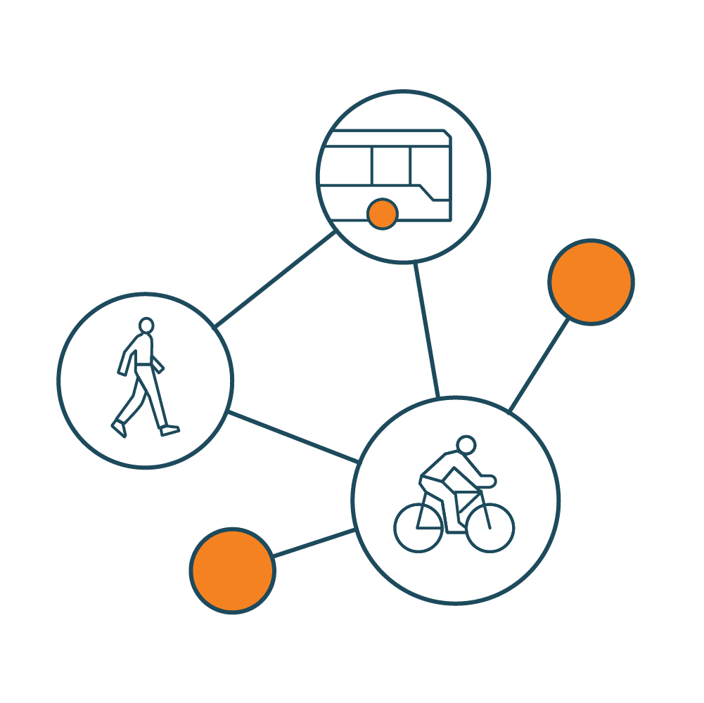
Creating new and improved connections as part of an integrated transport system that seamlessly connects into existing networks.
How we'll bring these principles to life:
Making crossings safer and easier, including east-west connections across South Road and other key locations.
Improving links to important destinations like schools, shops and community facilities.
Designing better connections to existing transport networks to support all road users.
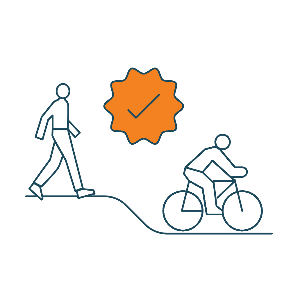
Providing positive journey experiences that are safe, efficient, comfortable, easy to navigate and enjoyable for everyone.
How we'll bring these principles to life:
Creating a consistent design that connects seamlessly with completed parts of the North-South Corridor.
Making it easy to find your way around, with clear landmarks and points of interest.
Adding comfort and safety features like shade, seating, and lighting for people walking or cycling to key destinations.
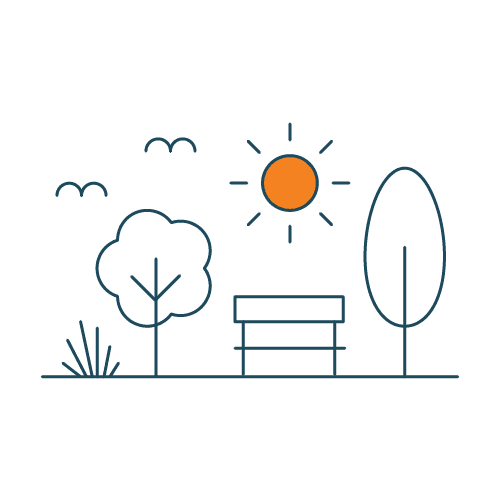
Creating cooler, greener and more resilient landscapes through green infrastructure, water and biodiversity sensitive urban design and enhancements to existing natural systems.
How we'll bring these principles to life:
Planting long-lasting native species to boost greenery and support local biodiversity.
Designing with water in mind, so stormwater is cleaner before it reaches local waterways.
Using durable, high-quality materials that look good over time, need little upkeep, and help prevent graffiti.
Connecting to existing infrastructure and enabling new economic, social and environmental opportunities for local businesses, surrounding communities and visitors.
How we'll bring these principles to life:
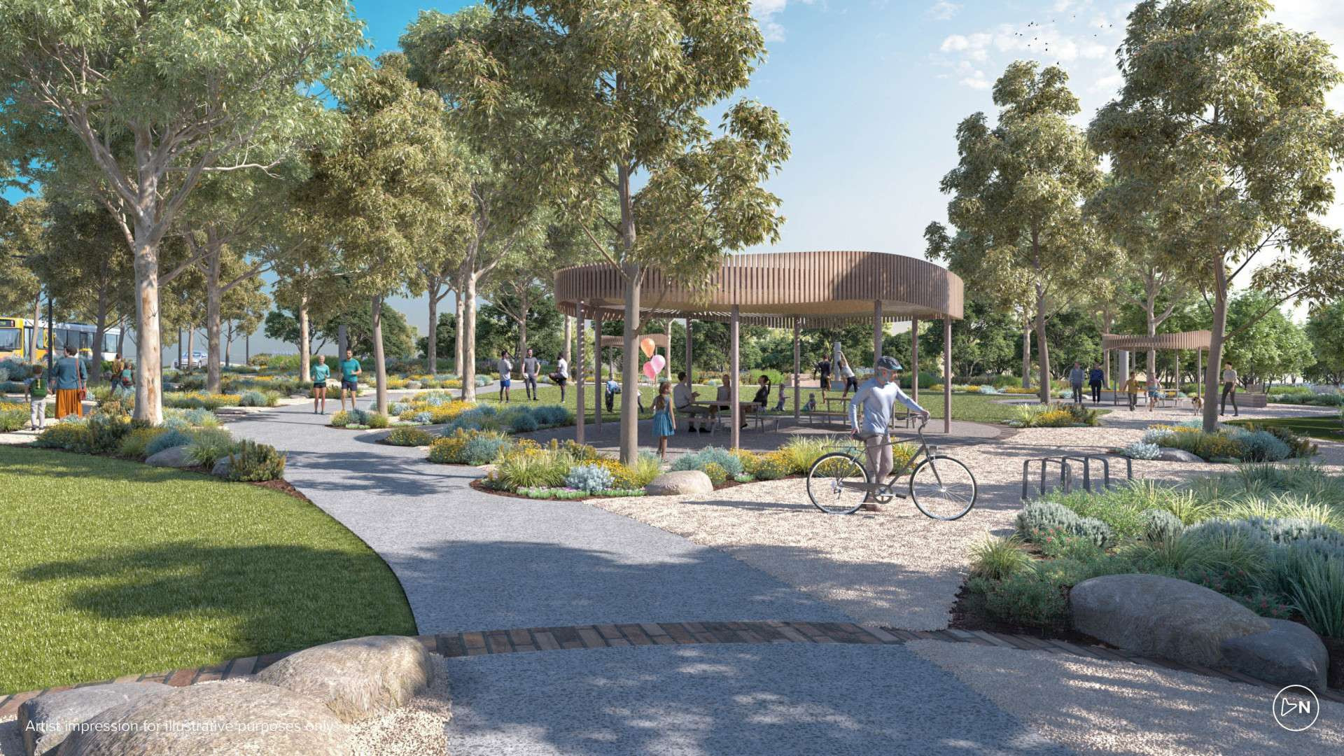
Creating new green spaces linked by walking and cycling paths, with room for both relaxation and activity.
Encouraging renewal in nearby suburbs by improving access and overall amenity.
Supporting local places and businesses by taking traffic off local roads and creating more attractive streets.
Respecting and celebrating the important heritage of the Kaurna peoples and drawing on local character and history to acknowledge the past and design for the future.
How we'll bring these principles to life:
Celebrating and recognising Kaurna culture with dual naming of places and new infrastructure.
Using local plants and natural elements like earth and water in designs that reflect the seasons.
Celebrating diverse community contributions seen in historic buildings, places and neighbourhoods.
We will work with the Kaurna Yerta Aboriginal Corporation and local Aboriginal stakeholders to integrate cultural expression into the urban design to reflect the Kaurna Peoples’ enduring and continuing connection to the lands on which the T2D Project will be constructed.
Benefits of good urban design
The T2D Project’s urban design will enhance both the new motorway and the communities along it. We’re creating opportunities for urban renewal with upgraded walking and cycling paths, green spaces and recreational areas.
Most importantly, the Project will complete the North-South Corridor, delivering a 78km non-stop South Road between Gawler and Old Noarlunga.
Connectivity
We’re building five shared use bridges, and new and upgraded paths to improve walking, cycling and access to public transport.
Communities will also benefit from new open spaces, playgrounds and sporting facilities.

Heritage
The design will protect key cultural and heritage sites, like Thebarton Theatre and Queen of Angels Church, while reflecting the rich heritage of local communities.
This ensures that the area's unique character is preserved, even as the city grows and evolves.
Walking and cycling
We’re creating more than 22km of new and upgraded paths for people walking and cycling along the corridor. These paths will be shaded by new tree canopy and include plenty of places to stop and rest.
By giving cyclists the option to ride away from traffic, we’re also making journeys safer.
Green spaces
We will increase tree canopy cover by 20%, deliver 26 hectares of new open space and strengthen local biodiversity and habitats.
We will plant 2000+ trees and 500,000 shrubs with at least half being native species.
Shaping Adelaide together
Our urban design concepts have been shaped by community and key stakeholder feedback as the Project has developed.
In 2023, the Department for Infrastructure and Transport (DIT) released the T2D Urban Design Strategy, which set the groundwork for how urban design would be integrated into the Project.
The strategy was informed by:
government policies and strategies
local area analysis
best practice project benchmarking
community and stakeholder engagement.
We've built on that to create 10 new open community spaces for people to connect, relax and enjoy. These spaces will also provide more opportunities for both play and sport – from playgrounds and grassed areas to courts and informal play spaces.
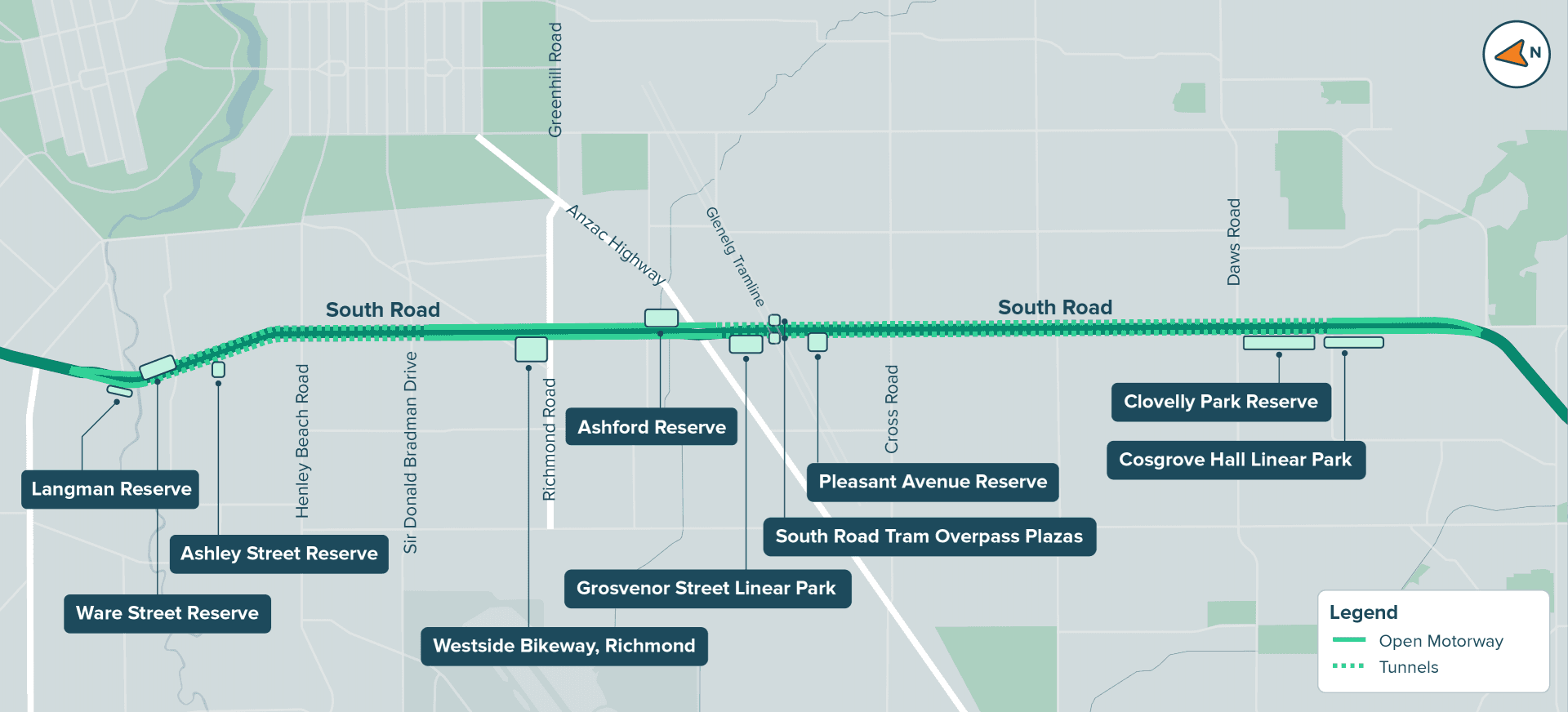
The location of each space is outlined on the map below. You can also view the updated draft designs in more detail by visiting the interactive map.
In 2026, we'll re-connect with local communities and stakeholders to provide further details on our designs.
The T2D Project will be constructed across three precincts - Northern, Central and Southern. Learn more about each precinct, including what we've heard so far and detailed descriptions of the proposed open spaces by clicking on the tabs below.
The Northen Precinct is located between Grange Road, West Hindmarsh and Ashley Street, Torrensville. It is the northern point of the T2D Project, where the 2.2km Northern Tunnels begin.
What we've heard so far
For this area, we’ve heard:
Keeping landmarks like the Brickworks kiln, Hindmarsh Cemetery and the Torrensville Bowling Club is important to local identity.
Improving access to Kings Reserve, Thebarton Oval and the River Torrens / Karrawirra Parri is a key focus.
New green space to complement facilities at Kings Reserve is needed.
Increasing amenity trees is important to provide shade and screening.
Creating stronger physical and cultural links with the newly relocated Warriappendi School is considered valuable for the community.
Key features
Entry and exit portal and maintenance and operations facility for the Northern Tunnels
Ware Street – 15,000 square metres of new community space
Langman Reserve – reimagined and upgraded
Trees – existing trees will be retained where possible and new plantings add to the green amenity
Ashley Street Reserve – upgraded facilities and connection to Thebarton Oval precinct
Enhanced walking and cycling paths to connect local areas of interest
Upgraded River Torrens Linear Park Trail, including a new path on the southern bank, crossing beneath South Road
Learn about Ware Street Reserve, Langman Reserve and Ashley Street Reserve by clicking on its tile below.
Ware Street Reserve

Located next to the River Torrens / Karrawirra Parri, Ware Street Reserve will become an impressive 15,000 square metres of new open space.
Langman Reserve

Langman Reserve will be refreshed with upgraded facilities, creating a community space that feels both familiar and newly revitalised.
Ashley Street Reserve

A redeveloped Ashley Street Reserve will complement nearby facilities and have well- connected paths and entrances.
The Central Precinct is located between Sir Donald Bradman Drive, Hilton, and Glengarry Avenue, Glandore. It is where the lowered open motorway joins the Southern and Northern Tunnels.
The area is crucial for east-west connectivity and accessing the Adelaide CBD and airport.
What we've heard so far
For this area, we’ve heard:
Gardens and landscaping are important, with trees and green canopy particularly valued.
Providing facilities which cater for different activities and abilities – both formal and passive recreation – is important.
Continuous path networks and good access to nearby facilities are needed.
Shielding neighbouring areas from traffic noise is a key focus for local communities.
The existing memorials to ANZACs at the Gallipoli Underpass and Anzac Highway are valued by communities.
Key features
Spans the southern end of the Northern Tunnels to the northern end of the Southern Tunnels, with around 2.7km of lowered open motorway in between.
Four shared use bridges across the motorway, each complemented by green open space.
Enhanced Westside Bikeway connection and new green space at Deacon Avenue.
Richmond Oval – green space at the eastern entrance adds to street appeal.
Access to Richmond Primary School improved with a dedicated shared use bridge, and existing large Ficus tree retained.
Shared use bridge at Tennyson Centre Day Hospital which has direct ramp connections to Brown Hill Creek on eastern and western sides.
Activated open space beneath the new tram overpass to provide local communities with more active travel and leisure options.
Tunnel maintenance and operations facility, along with the Telstra Exchange.
Dedicated shared use bridge providing improved access to Black Forest Primary School, with open community space on the western side of the motorway.
Enhanced walking and cycling paths connecting local areas of interest and to public transport, including the City-Glenelg tram at Glandore.
Existing trees retained where possible and new plantings in multiple zones to green the area.
Learn about Westside Bikeway, Ashford Reserve, Grosvenor Street Linear Park, Pleasant Avenue Reserve and the South Road Tram Overpass Plazas by clicking on its tile below.
Westside Bikeway, Richmond

A dedicated shared use bridge across the motorway to complement the Westside Bikeway, with landscaped areas and shaded rest stops.
Ashford Reserve

Landscaped areas surrounding a new shared use bridge, providing access between Herbert Road and the Tennyson Centre Day Hospital.
Pleasant Avenue Reserve

A new green open space in Glandore, with a dog park, plaza areas and shared use bridge providing direct access to Black Forest Primary School.
Grosvenor Street Linear Park

A new linear park, offering a welcoming green space and active travel corridor between Grosvenor Street and the new motorway.
South Road Tram Overpass Plazas

The spaces beneath the newly rebuilt South Road Tram Overpass will be carefully re-imagined for the local community.
The Southern Precinct is located between Norrie Avenue, Clovelly Park, and Tonsley Boulevard, Tonsley. It is the southern point of the T2D Project, where the 4.5km Southern Tunnels begin.
What we've heard so far
For this area, we’ve heard:
Tree planting should focus on walking and cycling routes, recreation areas and locations that provide a buffer for residential areas from the motorway.
Safe connections to schools, public transport and recreation areas are important.
Desire for community spaces near existing halls and playgrounds.
Key features
Southern entry point of the T2D Project, where the 4.5km Southern Tunnels begin.
Cosgrove Hall Linear Park – a new green corridor improving amenity and visual appeal in front of the motorway.
Clovelly Park Reserve – a new community space on York Avenue.
Tunnel maintenance and operations facilities, along with a substation supporting the Southern Tunnels.
Tree retention where possible and new plantings to improve green canopy.
Enhanced walking and cycling paths connecting local schools, transport and recreation areas.
Dedicated shared use bridge providing safe access to St Bernadette’s School.
Learn about Cosgrove Hall Linear Park and Clovelly Park Reserve by clicking on its tile below.
Cosgrove Hall Linear Park

A new biodiversity corridor at Clovelly Park with a variety of native plants that attract bees and birds, helping nature to thrive.
Clovelly Park Reserve

A new space opposite Clovelly Park Community Hall. It will feature a playground and open space for a variety of activities.
Resources
Download the fact sheets to learn more.
Roll plots
A roll plot is a detailed diagram that displays the design and layout of a project form an aerial view. Download the role plots below to view the urban design concepts for the surface level changes to South Road including:
project boundary line, indicating the extent of T2D surface works (there is no physical boundary)
new South Road surface roads and central motorway
tunnel entry and exit portals, maintenance and operations facilities
cyclist, pedestrian and shared use pathways and overpasses
bus stops
proposed noise walls
proposed restrooms, green spaces.
The roll plots have been updated to reflect changes to the design that have been made since the Alliance was formed in 2024.
Some aspects of the design, such as the exact location and height of noise walls in many locations, are still to be finalised.
As the Project's design advances, we'll come back to the community in 2026 with more details about our urban design concepts and elements that will be alongside the T2D motorway.